

Descrição
Este percurso combina três elementos bem característicos da Serra da Lousã: a água, o xisto e as magníficas vistas panorâmicas proporcionadas pela altitude da serra. Durante o percurso terá oportunidade de passar por cascatas, por uma levada, por duas aldeias de xisto – Candal e Cerdeira – e ainda pelo Cabeço da Ortiga, com os seus 928 metros de altitude. Venha daí, traga a sua boa disposição e parta à aventura num percurso que é uma compilação do melhor que a Serra da Lousã tem para oferecer a quem a visita.
ATENÇÃO: este percurso NÃO É ACONSELHÁVEL para pessoas que sofram de VERTIGENS, TONTURAS e/ou DESEQUILÍBRIO!
Ponto de Encontro: Castelo da Lousã, no parque de estacionamento
Coordenadas (Google Maps): 40.100308513179876, -8.235656075246805
Coordenadas (Google Earth): Latitude: 40° 6’0.52″N; Longitude: 8°14’8.13″W
Horário: os participantes devem estar às às 8:45 no ponto de encontro; a caminhada tem início às 9:00
Percurso: Circular
Distância: 16,2km
Dificuldade: Difícil
Duração prevista: 6 a 7 horas
Preço: 10€ (25% de desconto em inscrições até 29 Janeiro 2023 = 7,5€)
Inclui:
Guia;
Seguro de Acidentes Pessoais;
Seguro de Responsabilidade Civil;
1 Snack.
Não inclui:
Transporte até ao ponto de encontro;
Refeições;
Outros não especificamente descritos como incluídos.
Limite de idade: devido à natureza e/ou nível de dificuldade deste percurso, todos os participantes devem ter pelo menos, 16 anos.
Cada participante deverá levar consigo:
– água suficiente para a extensão/duração do percurso;
– farnel (almoço ao estilo piquenique – recomendamos sandes);
– boné/chapéu;
– impermeável;
– roupas confortáveis e leves;
– calçado confortável e com um bom nível de aderência;
– recomenda-se que leve alguns snacks (por exemplo barras energéticas) e/ou fruta.
A inscrição deve ser feita até 24 horas antes da hora de início da caminhada.
“Water, Schist and Altitude Route”
5th February
This route combines three very characteristic elements of Serra da Lousã: water, schist and the magnificent panoramic views provided by the altitude of the mountain. During the journey you will have the opportunity to pass by waterfalls, a levada, two schist villages – Candal and Cerdeira – and also Cabeço da Ortiga, at 928 meters high. Come there, bring your good mood and go on an adventure on a route that is a compilation of the best that Serra da Lousã has to offer to those who visit it.
IMPORTANT: this route IS NOT RECOMMENDED for people suffering from DIZZINESS and/or IMBALANCE!
Meeting Point: Lousã Castle, in the car park
Coordinates (Google Maps): 40.100308513179876, -8.235656075246805
Coordinates (Google Earth): Latitude: 40° 6’0.52″N; Longitude: 8°14’8.13″W
Time: participants must be at 8:45 am at the meeting point; the hike starts at 9:00 am
Route type: Circular
Length: 16,2km
Difdiculty: Hard
Expected duration: 6 to 7 hours
Price: 10€ (25% discount on registrations until 29 January 2023 = 7,5€)
Includes:
Guide;
Personal Accident Insurance;
Liability insurance;
1 Snack.
Does not include:
Transportation to the meeting point;
Meals;
Others not specifically described as included.
Age limit: due to the nature and/or level of difficulty of this route, all participants must be at least 16 years old.
Each participant must bring with them:
– enough water for the length of the route/duration of the hike;
– lunch (picnic style – we recommend sandwiches);
– cap / hat;
– waterproof jacket;
– comfortable and light clothes;
– comfortable shoes with good grip;
– it is recommended that you take some snacks (for example energy bars) and/or fruit.
Registration must be done up to 24 hours before the start time of the hike.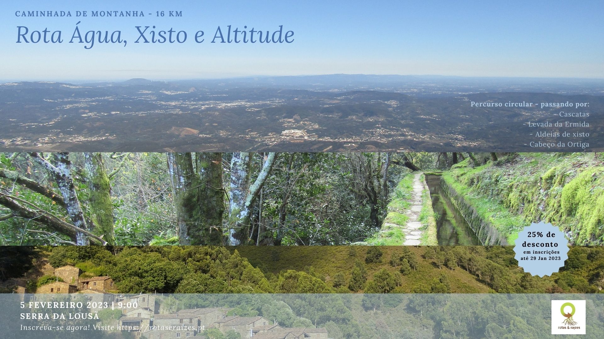


Avaliações
Ainda não existem avaliações.