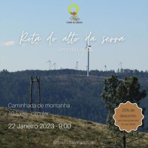
Descrição


22 Janeiro
Com o seu início junto ao famoso baloiço do Trevim, este percurso leva-o à descoberta de toda a zona envolvente, no alto da serra da Lousã. Venha embrenhar-se na magia desta serra, percorrendo bosques, apreciando as magníficas vistas panorâmicas e disfrutando da beleza de um vale quase secreto localizado acima dos 900 metros.
Ponto de Encontro: estacionamento do Baloiço “Isto é Lousã” (Baloiço do Trevim)
Coordenadas (Google Maps): 40.0767310509633, -8.189999259904013
Coordenadas (Google Earth): Latitude: 40° 4’35.70″N; Longitude: 8°11’23.92″W
Horário: os participantes devem estar às às 8:45 no ponto de encontro; a caminhada tem início às 9:00
Percurso: Circular
Distância: 10,4km
Dificuldade: Moderada
Duração prevista: 3 a 4 horas
Preço: 10€ (25% desconto em inscrições até 15 Janeiro 2023 = 7,5€)
Inclui:
Guia;
Seguro de Acidentes Pessoais;
Seguro de Responsabilidade Civil.
Não inclui:
Transporte até ao ponto de encontro;
Refeições;
Outros não especificamente descritos como incluídos.
Limite de idade: devido à natureza e/ou nível de dificuldade deste percurso, todos os participantes devem ter pelo menos, 12 anos.
Cada participante deverá levar consigo:
– água suficiente para a extensão/duração do percurso;
– boné/chapéu;
– impermeável;
– roupas confortáveis e leves;
– calçado confortável e com um bom nível de aderência;
– recomenda-se que leve alguns snacks (por exemplo barras energéticas) e/ou fruta.
A inscrição deve ser feita até 24 horas antes da hora de início da caminhada.
“Mountain top route”
22nd January
Starting next to the famous Trevim swing, this route takes you to discover the entire surrounding area, at the top of Serra da Lousã. Come and immerse yourself in the magic of this mountain range, walking through woods, appreciating the magnificent panoramic views and enjoying the beauty of an almost secret valley located above 900 meters.
Meeting Point: “Isto é Lousã” swing parking lot (Trevim swing)
Coordinates (Google Maps): 40.0767310509633, -8.189999259904013
Coordinates (Google Earth): Latitude: 40° 4’35.70″N; Longitude: 8°11’23.92″W
Time: participants must be at 8:45 am at the meeting point; the hike starts at 9:00 am
Route type: Circular
Length: 10,4km
Difdiculty: Moderate
Expected duration: 3 to 4 hours
Price: 10€ (25% discount on registrations until 15 January 2023 = 7,5€)
Includes:
Guide;
Personal Accident Insurance;
Liability insurance.
Does not include:
Transportation to the meeting point;
Meals;
Others not specifically described as included.
Age limit: due to the nature and/or level of difficulty of this route, all participants must be at least 12 years old.
Each participant must bring with them:
– enough water for the length of the route/duration of the hike;
– cap / hat;
– waterproof jacket;
– comfortable and light clothes;
– comfortable shoes with good grip;
– it is recommended that you take some snacks (for example energy bars) and/or fruit.
Registration must be done up to 24 hours before the start time of the hike.


Avaliações
Ainda não existem avaliações.